


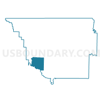
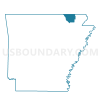
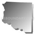
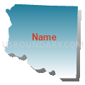
Spring River Voting District, Randolph County, Arkansas
About
Outline

Summary
| Unique Area Identifier | 527947 |
| Name | Spring River Voting District |
| County | Randolph County |
| State | Arkansas |
| Area (square miles) | 20.73 |
| Land Area (square miles) | 20.73 |
| Water Area (square miles) | 0.00 |
| % of Land Area | 100.00 |
| % of Water Area | 0.00 |
| Latitude of the Internal Point | 36.23857100 |
| Longtitude of the Internal Point | -91.17279080 |
Maps

Graphs
Select a template below for downloading or customizing gragh for Spring River Voting District, Randolph County, Arkansas


Neighbors
Neighoring Voting District (by Name) Neighboring Voting District on the Map
- Butler Voting District, Randolph County, AR
- DENT Voting District, Lawrence County, AR
- Jane's Creek Voting District, Randolph County, AR
- Water Valley Voting District, Randolph County, AR
- West Roanoke Voting District, Randolph County, AR
Top 10 Neighboring County Subdivision (by Population) Neighboring County Subdivision on the Map
- Dent township, Lawrence County, AR (1,009)
- West Roanoke township, Randolph County, AR (797)
- Janes Creek township, Randolph County, AR (702)
- Spring River township, Randolph County, AR (344)
- Water Valley township, Randolph County, AR (289)
- Butler township, Randolph County, AR (57)